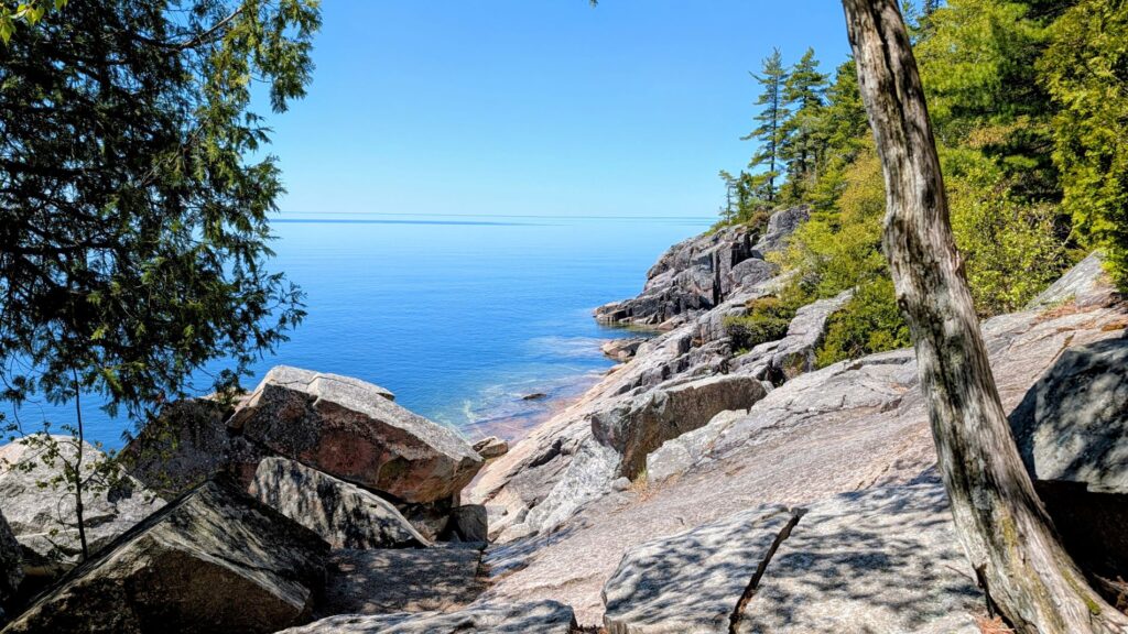
From Neys Provincial Park (see the previous post to read about all the great things we did there), we traveled to Lake Superior Provincial Park for three nights. We had no idea how HUGE this provincial park is, so we ended up only exploring the southern end, near our campground. If we had it to do over, we would have stayed longer and split our time between the northern and southern ends of the park. There is so much to see and do here!
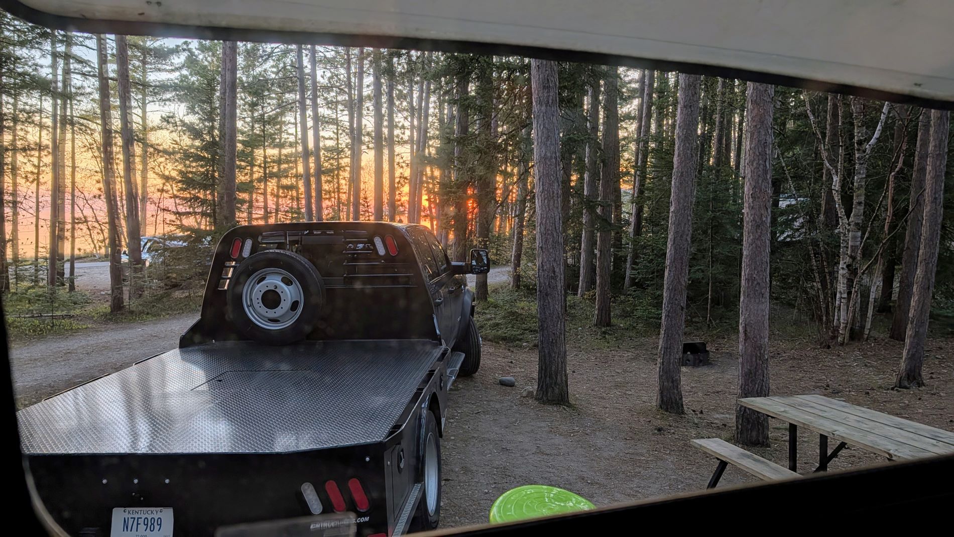
For this visit, however, we stayed in the Agawa Bay Campground. This campground is sandwiched between Lake Superior and the Trans-Canada Highway, and is thus VERY noisy. Luckily, we were in one of the middle roads of the campground, but still, it is narrow, so you are never able to escape the sounds of the highway, no matter what site you are in. We did feel really bad for those staying closest to the road, though. We at least had some trees to dampen the highway noise a little. This campground is also very tight. We would not feel comfortable going into it in a rig any larger than what we have (crewcab truck with 9’4” bed and 25’ travel trailer). The sites themselves are fairly large, but the campground is heavily treed and those trees are right up next to the narrow campground roads. Making the turns, especially into and out of the sites, is tricky! In addition, our power pedestal was so far away from our site that we couldn’t reach it even with our two 30amp cords. We had to use a regular extension cord to take us the distance and therefore only had 15amp service while there. For all these reasons mentioned, it was not our favorite campground of the trip. It did have some great features, though, including the gorgeous Lake Superior views, and a being within walking distance of the visitor center.
This was also the most crowded of the parks we visited on this journey. Still, our early season visit worked in our favor. Even being the most crowded, the campground was never full, and there were never so many people that it took away from our experience. And while there were more people around in the campground and on the beach, we never saw more than a handful of people on the hikes we went on. Being busier, did have its advantages, too. For instance, this was the only park we visited that had an open visitor center, and it was a pretty good one! The rangers were helpful in giving recommendations for our time, and there were lots of exhibits teaching about the lake, along with the people and animals who call the area home. We love being able to learn about an area in the visitor center before getting out to explore on our own.
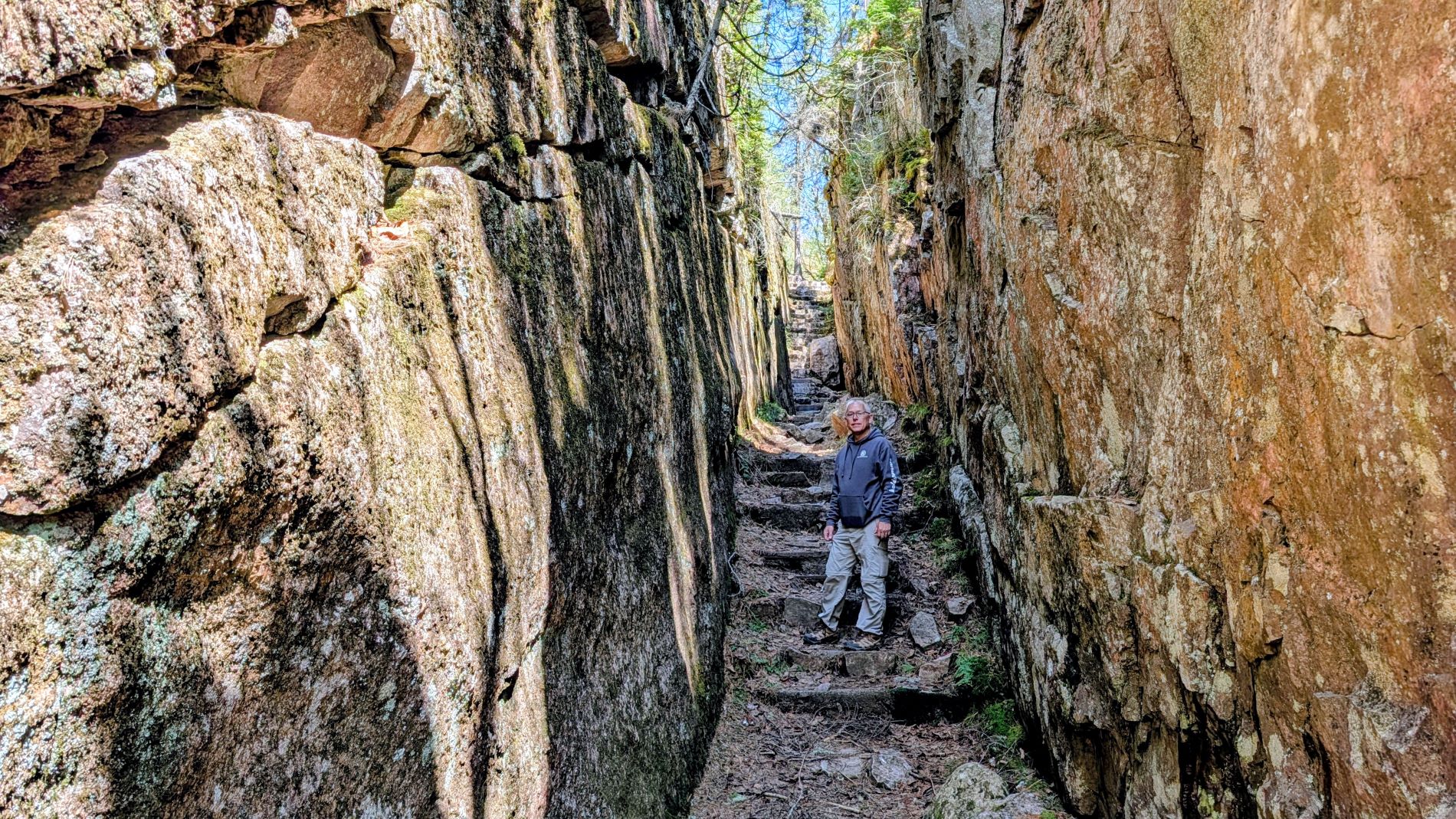
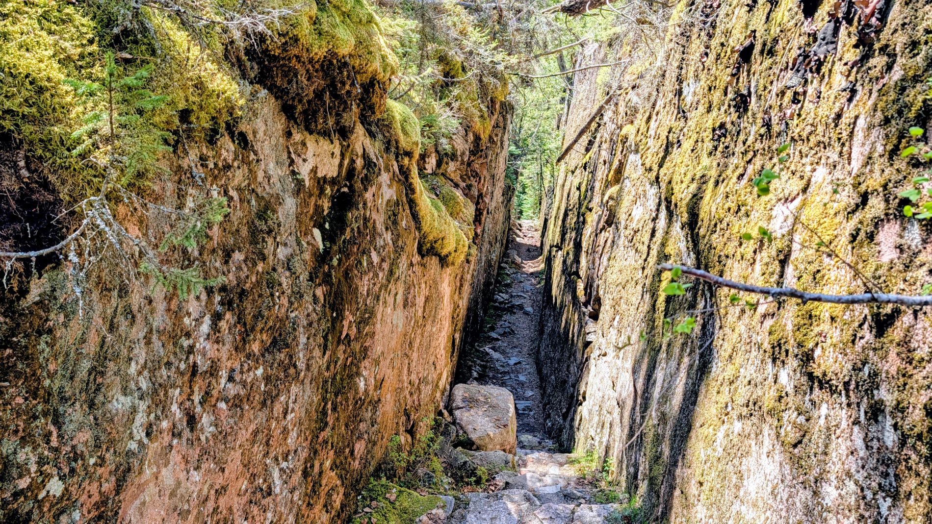
We started our visit by taking the short hike to the Agawa Rock Pictographs. This was the most “crowded” trail of our visit, and we counted a total of seven other people the entire time we were on the trail. Even if you don’t factor in the pictographs, the trail alone is interesting, as it travels through and beside some volcanic basalt dykes. This is where lava flowed into the fractures in the granite, then later eroded away leaving large fissures that resemble – to us, at least – slot canyons. It was unexpected and fun to get to travel through one as part of the trail! The main attraction here, though, is the pictographs. This is a sacred site to the Ojibwe people, so it is requested that no photos or video are taken of the images. We, of course, complied, so we have nothing to show you of the pictographs, but a quick Google search will show you hundreds of images from those who did not (although we have to defend our fellow hikers a little here…there was nothing on site asking for no photos or video to be taken. We only read that request online before our visit, so others just may not have known). Anyway, to give you a little information about the location…the pictographs are on a cliff directly above Lake Superior. To be able to see them, you either need to be on the water (kayaks would be great here) or you have to hike out onto rocks that slope somewhat steeply toward the lake. Truthfully, Heather freaked out a bit here and originally said she wasn’t going to do it, but after a few minutes of assessing the situation she managed to get out on the rocks enough to see the pictographs. Once out there, she got more comfortable and was able to move around more freely. Coming back was definitely less scary than going out! A couple of words of caution, though. We would definitely not recommend doing this if the rocks are wet or if Lake Superior is anything but flat water. Waves, wind, and wet would not be your friend here. We also wouldn’t really recommend this outing for children. At any rate, the pictographs are pretty awe inspiring, so you should definitely give it a try if you are comfortable doing so. From our vantage point we were able to see about a dozen images, though a kayaker told us there were more around the corner that we could not get to. This trail is open seasonally, and only opened a couple of days before our visit, so you should check that if you are interested in visiting yourself.
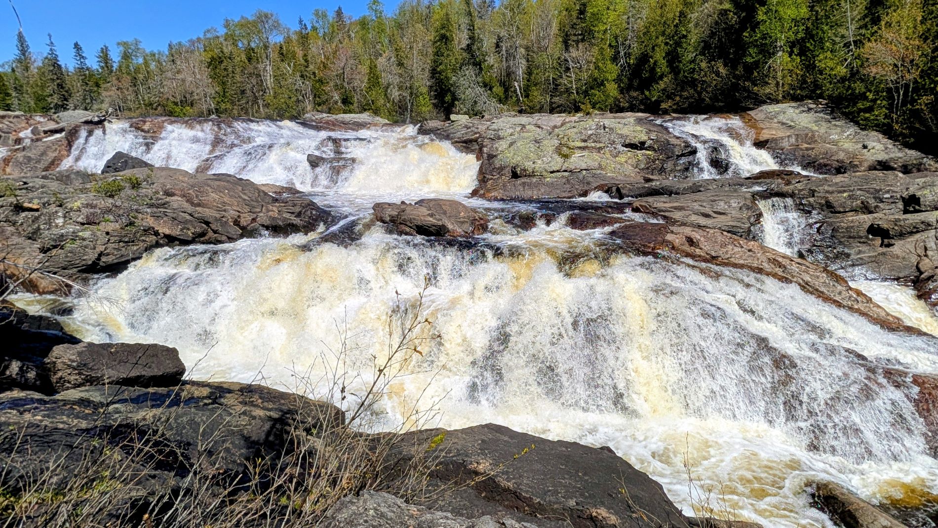
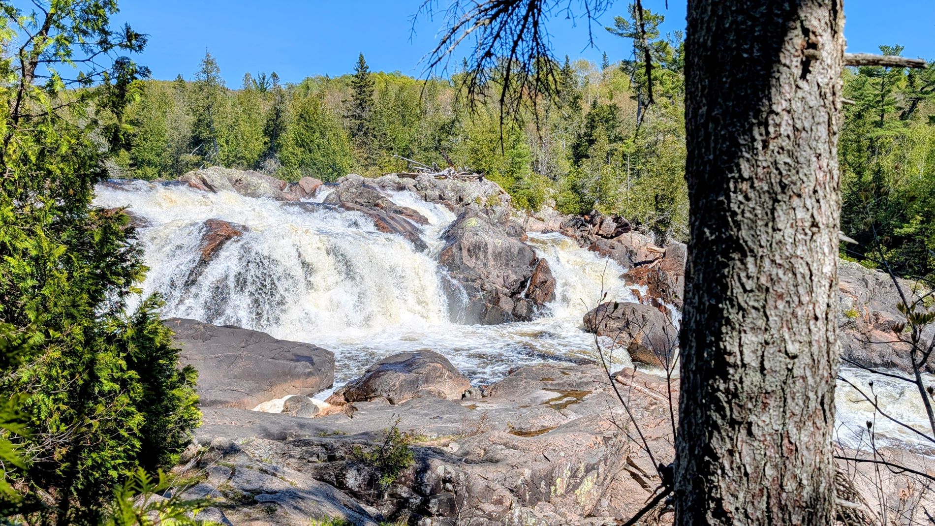
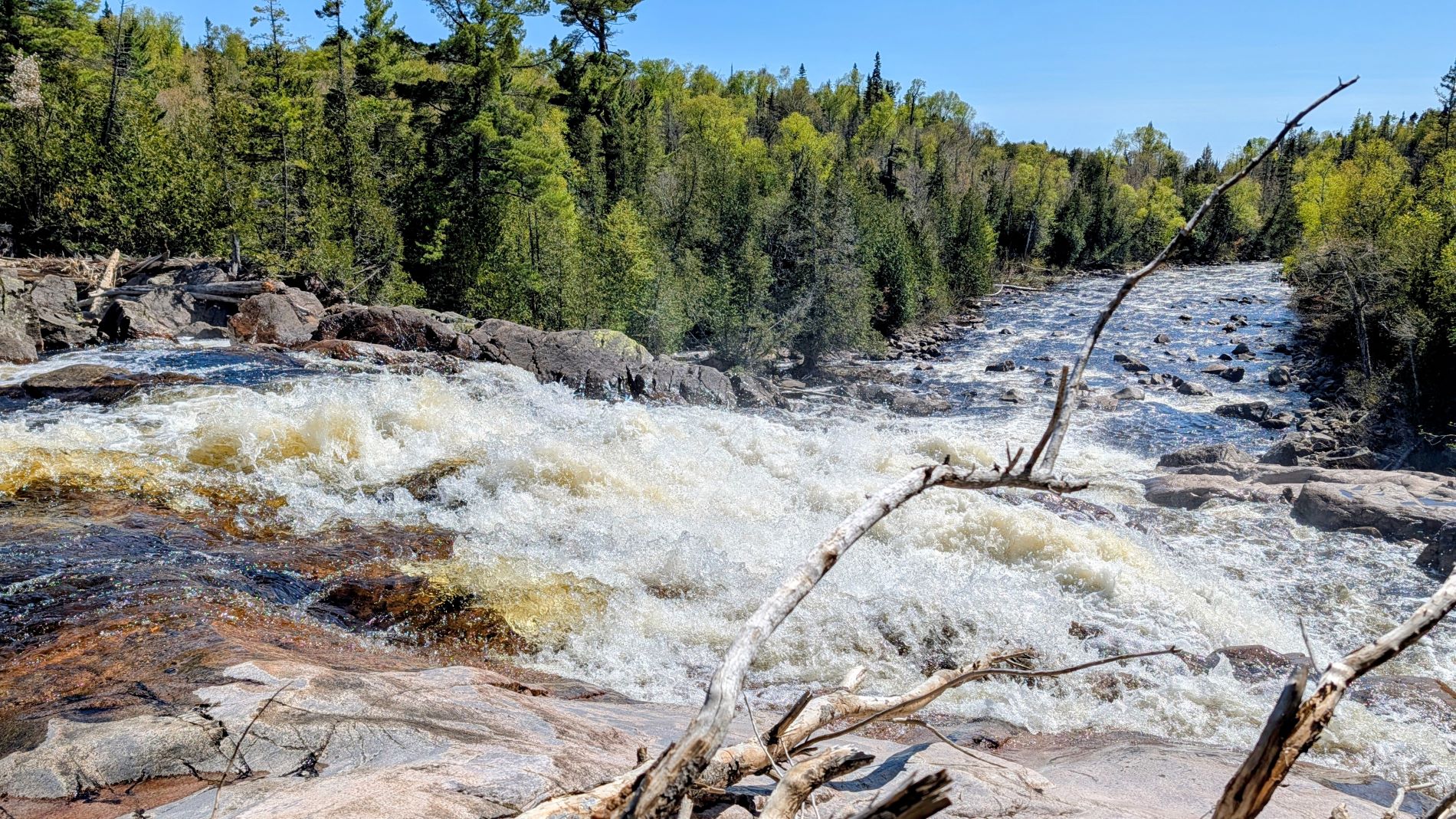
When we were asking the ranger in the visitor center about trails we should try, she gave us a couple of suggestions and then, as an afterthought, threw in that we might like the Pinguisibi Trail if we had extra time. Readers, it was our favorite adventure of this entire trip. It is definitely not an afterthought trail! This trail follows the Sand River upstream where there are multiple MASSIVE cascades. The trail is fairly easy, the views of the cascades are wide open, and there are lots of places you can get out to scramble on the rocks along the river. Everything about it was phenomenal. We both said multiple times that we couldn’t believe we were in Ontario here. It felt very much like we were at one of the beautiful streams or rivers out west in an iconic location such as Glacier National Park!
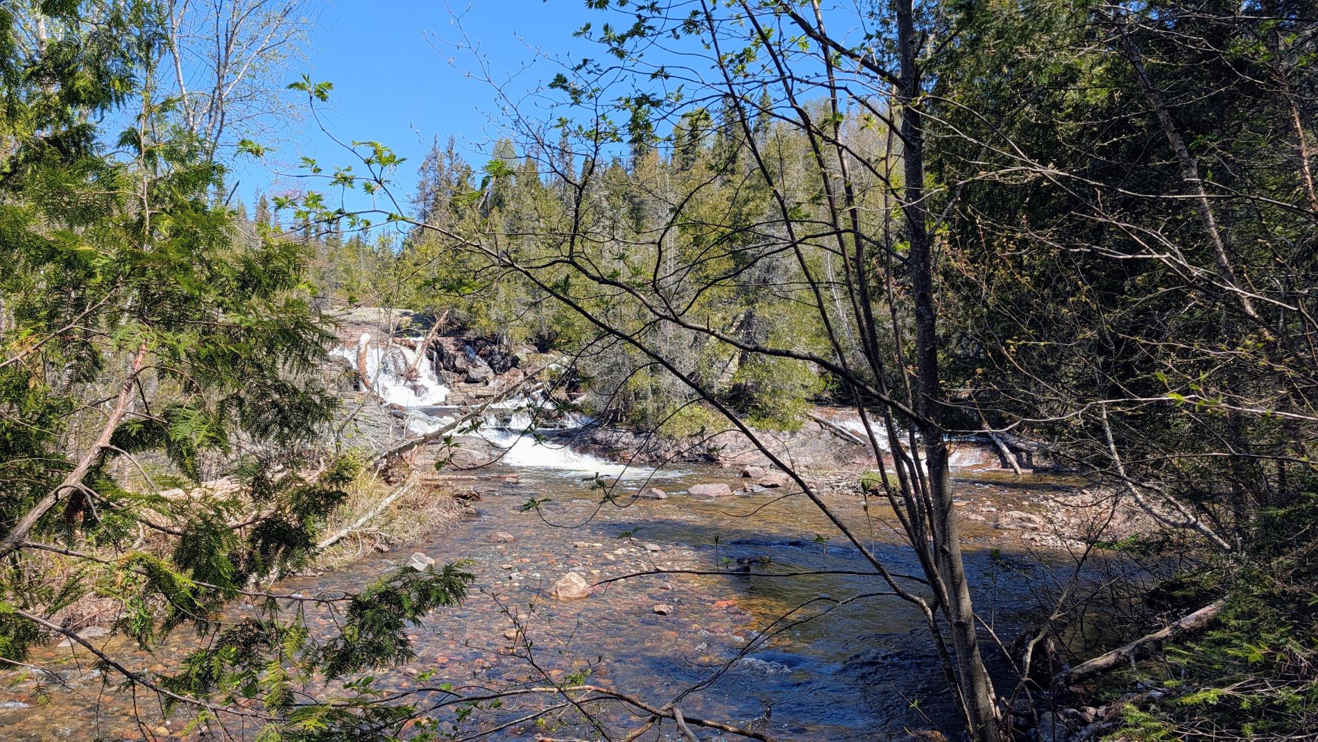
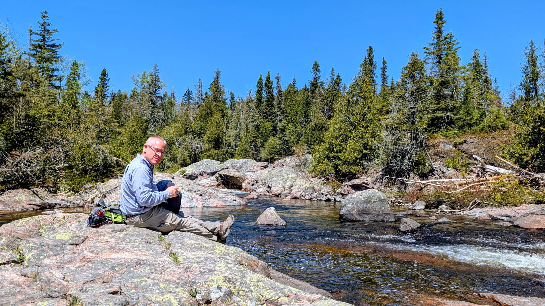
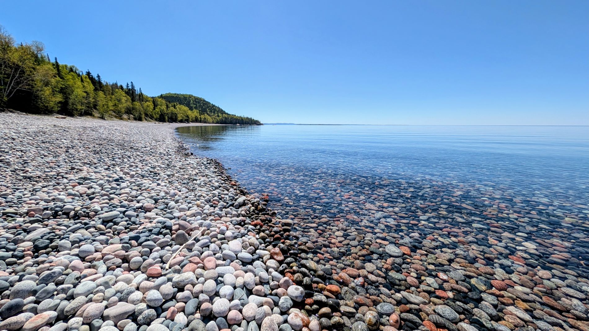
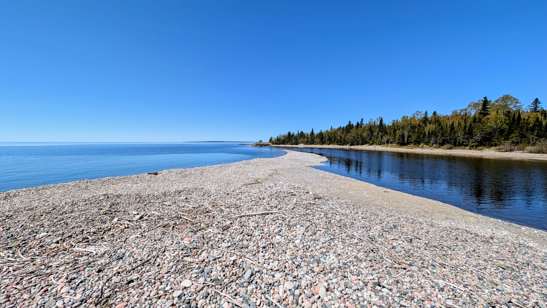
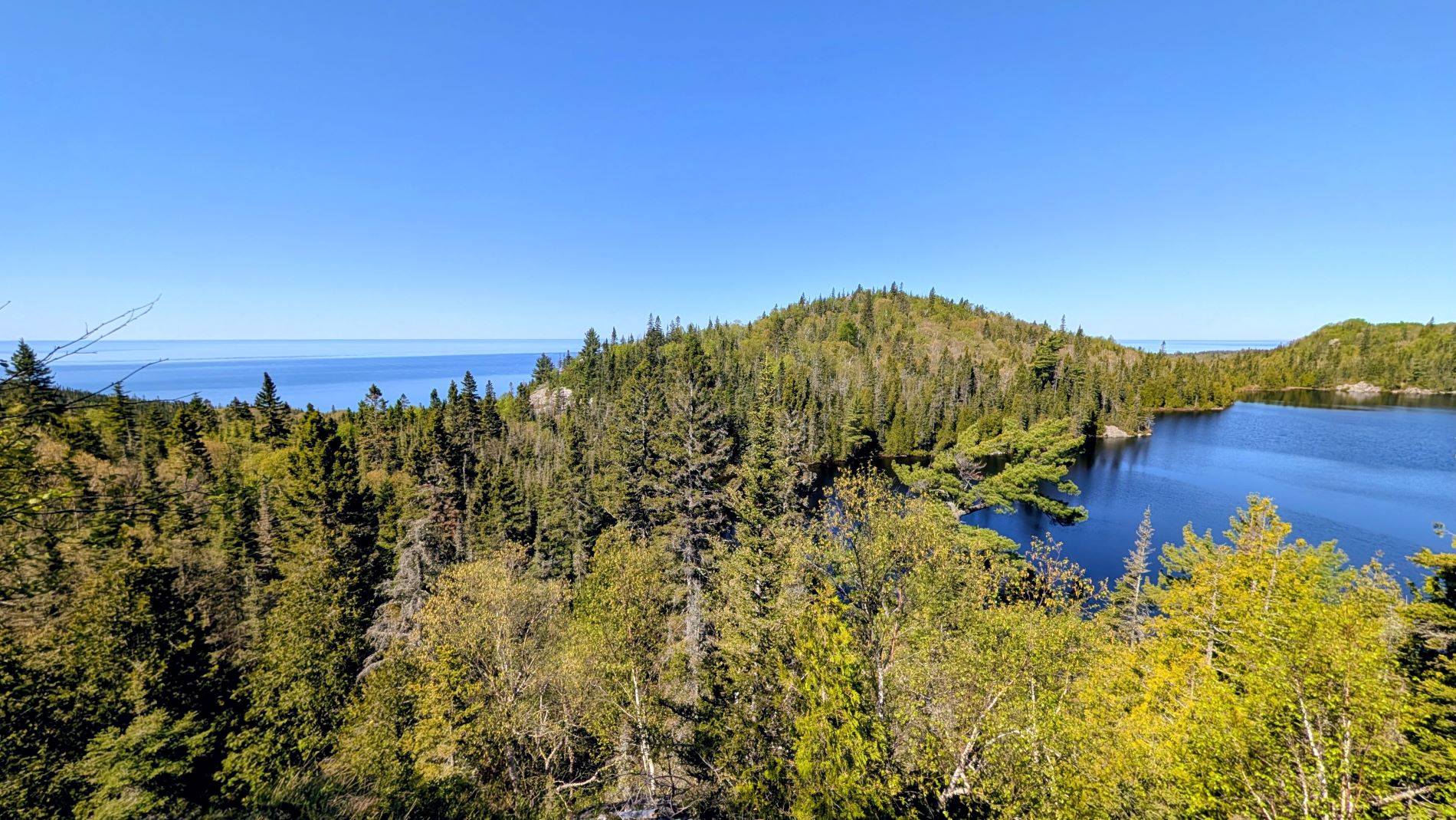
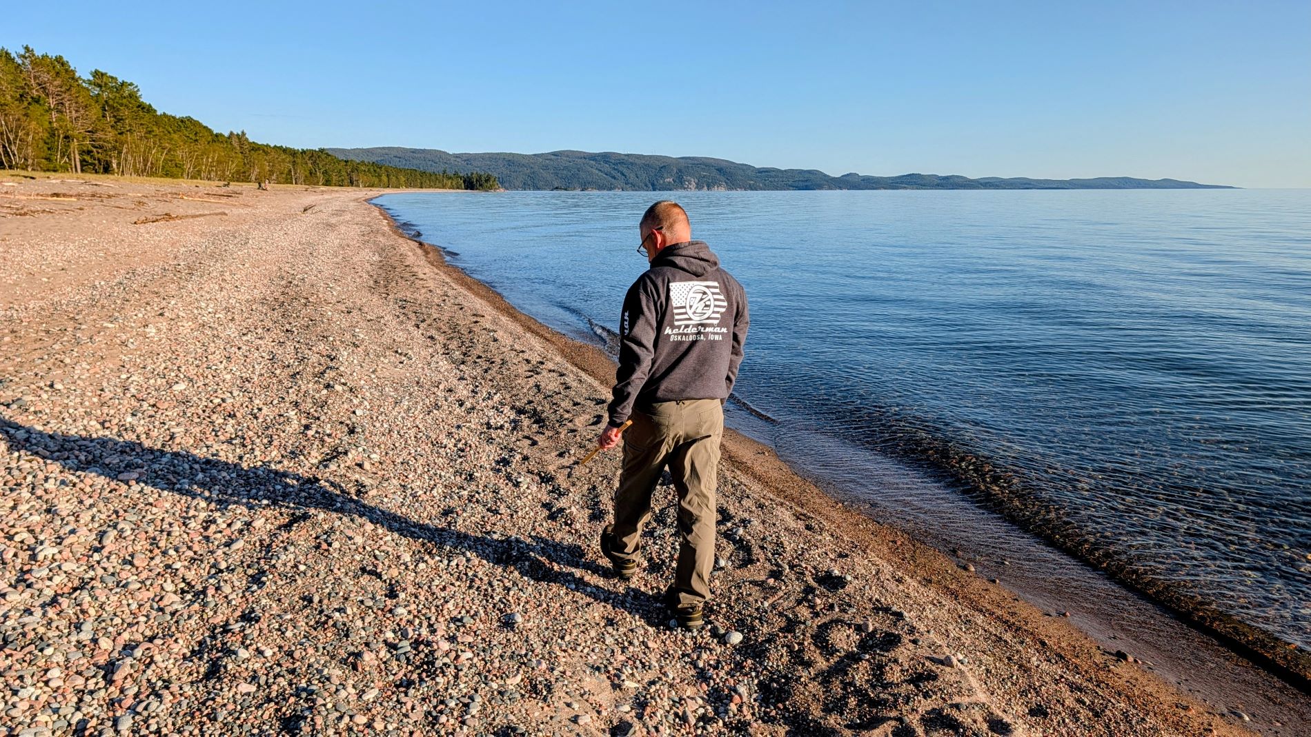
The ranger’s favorite trail that she highly recommended was the Orphan Lake Trail, and it did not disappoint, either. This trail touched on a little bit of everything! It traveled high up to an overlook where you could see both Orphan Lake and Lake Superior, down to the water of Orphan Lake, along a stone beach on Lake Superior, and followed the Baldhead River upstream to a beautiful cascade. In a mere 5 miles, we felt like we got a good taste of all the different features this park has to offer.
Only having two full days in this park was not enough. We feel like we barely scratched the surface! On our next visit, we will have to base our stay in the northern section of the park so we can explore areas like Old Woman Bay, Rabbit Blanket Lake, Mijinemungshing Lake, etc.! It seems that we are never able to check a place off our list…we always leave wanting more!
Until next time!